A “People-less Paradise”? What Archaeology Tells Us About the Climate Crisis and the “Emptiness” of Scotland’s Highlands and Islands
As we wrestle with the climate crisis and the impacts of social inequality in the 21st century, archaeology can help bring real world benefits to communities across Scotland by dispelling myths about the history of “emptiness” in the Highlands and Islands.
Scotland’s “romantic wilderness”
Popular media and travel writers have presented Scotland’s Highlands and Islands as a “romantic wilderness” or “people-less paradise” for centuries.
More recently, there’s been a push to restore, reforest and rewild some of these landscapes to reduce our own impact on the “natural” environment in the 21st century to prevent further biodiversity loss (decline or disappearance of the variety of living things) and to capture carbon emissions (which intensify the greenhouse effect on our planet).
While it’s essential that steps are taken to mitigate climate change, some have criticised this approach by asking how these visions for the future of our Highland and Islands landscape are being produced: how do we restore or rewild a landscape? What does it mean to be wild? And whose vision should be followed?
Through archaeology we can challenge the use of imagined “wild” pasts and understand that this “emptiness” is a modern phenomenon created through unjust “improvements” introduced in the recent past, from the extinction of the wolf and “pacification” of the Highlander in the early modern period, to the development of sporting estates and the manufacturing of an empty, wild and rugged Highland landscape inspired by the American West in the 19th and 20th centuries.
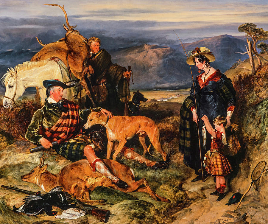
Scene in the Highlands with Portraits of the Duchess of Bedford and Duke of Gordon, by Edwin Landseer 1825 (Image credit: Edwin Landseer, Public domain, via Wikimedia Commons)
How can archaeology change how we represent Scottish landscapes?
Archaeology can help put people back into the frame of a landscape which has previously been portrayed as an “authentic” playground for tourists. By considering the past busyness of our upland landscapes (areas of high or hilly land) and challenging tired notions of these places being on the margins, transitional or empty, we can produce richer and more nuanced narratives which explore the diverse ways that humans have managed Scotland’s mountain landscapes in the past.
In the early modern period (around 1500 to 1800), the Scottish Highlands and Islands were home to a far larger population than today, with settlements scattered up the glens and shieling grounds occupying the higher slopes.
The shieling system in Scotland developed in the medieval period (AD 400 to 1500) and continued to be in use across the Highlands and Islands of Scotland until the 1700s or early 1800s. The term relates to the seasonal movement of livestock and a community of herders from the winter townships to higher (or “upland”) pastures known as the shieling grounds (“Àirigh” in Gaelic). This community of herders would mostly be comprised of the young women of the settlement who’d mind the cattle and make cheese and butter from the milk.
Alongside these shieling grounds, the uplands would’ve been home to a complex system of practices including woodland management, charcoal burning, illicit stilling, peat cutting and hunting.
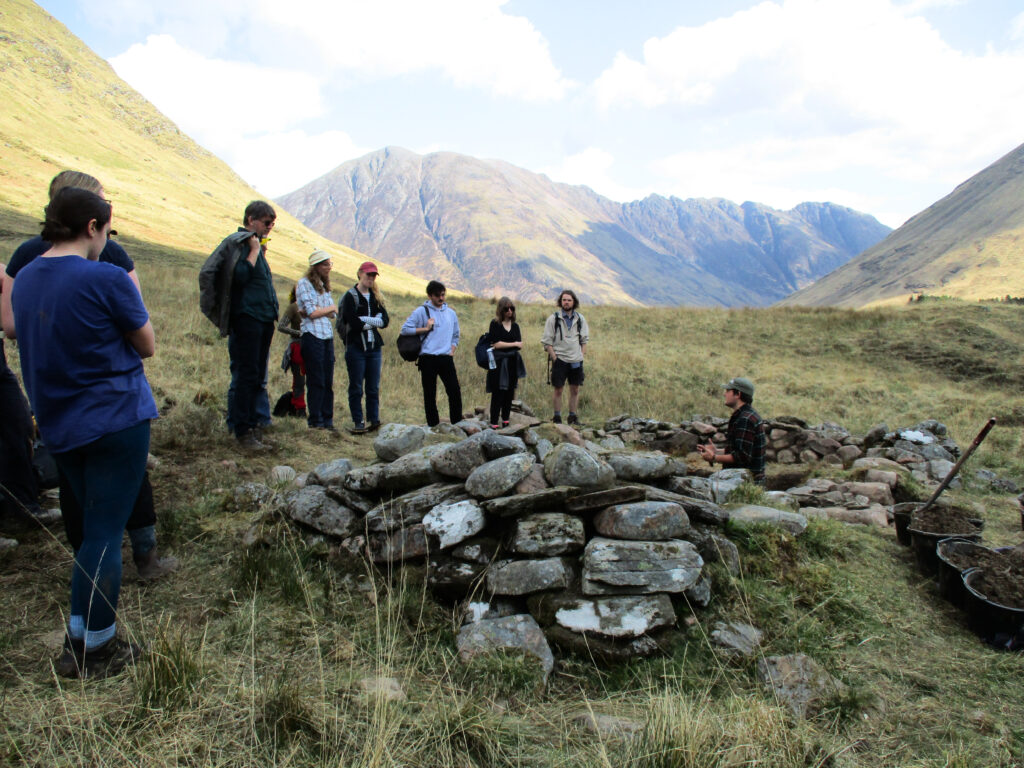
A site tour at the 2022 excavations of a shieling hut and whisky bothy in Gleann Leac-na-Muidhe, Glencoe. This site and the shielings, stances and charcoal burning platforms which cluster around it highlight the busyness of these uplands (Image copyright: Gemma Smith)
Thanks to surveys and excavations in Glencoe in the Highlands, as well as routeways on maps and ones still visible as tracks and paths, it’s been possible to explore the networks of movement between many of these activities, including the re-use of shieling structures for illicit whisky stilling in the early 1800s.
During excavations at the site of the ‘Summerhouse of MacIain’ in 2023, a rich collection of imported European, English and Eastern Scottish ceramics also highlighted just how connected the Highland landscape was to wider flows of trade and exchange. In addition, they demonstrated that high status hunting and feasting was occurring just across the river from the supposedly “transitional” and “marginal” pastures at the shielings.
Through this fieldwork, and previous studies of shieling landscapes such as the Ben Lawers Project in the Highlands and Bennachie Landscape Project in Aberdeenshire, outdated notions of a lone milkmaid at her shieling can be cast aside and the busy (and sometimes industrial) pasts of our upland landscapes can be revealed.
In reality, as you hike up hill passes or drive across certain roads, you might be following in the footsteps of milkmaids, peat cutters, whisky smugglers, or thousands of cattle and parties of drovers which would’ve been all around you a few centuries ago.
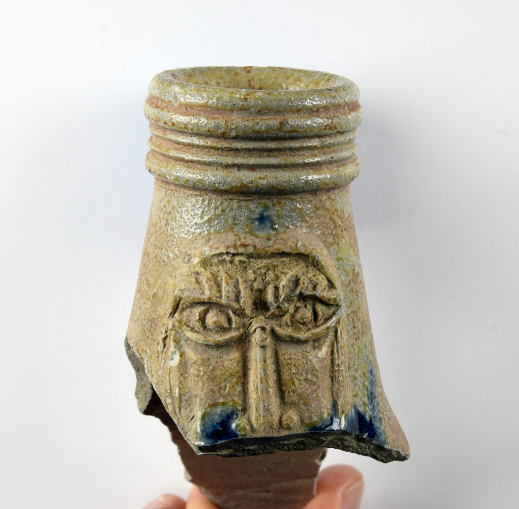
A large fragment of a Bartmann jug uncovered at the site of the ‘Summerhouse of MacIain’ in 2023. Bartmann jugs were produced in towns along the Rhine in Germany in the 16th and 17th centuries, and would’ve been traded to Scotland carrying beer and wine. The pottery assemblage from this site, along with the 2023 discovery of the ‘Glencoe hoard‘, highlights how connected the Highlands were to the rest of Europe (Image copyright: Dr Michael Given)
The future of Scotland’s rural landscapes and their communities hinge on decisions made as part of our response to the global climate crisis, the effects of which we’re already feeling through increased storm events and unpredictable seasons.
By dispelling myths of a history of Highland and Islands “emptiness”, archaeology has a key role to play in helping us approach these decisions in a sustainable and equitable way that supports those communities in Scotland which will be impacted the most.
If you’d like to keep reading about the relationship between archaeology and climate change, dig into these other articles on the Dig It! website.
By Eddie Stewart FSAScot. Eddie is a PhD researcher at the University of Glasgow and is co-director of the Landscapes of Glencoe and Rannoch Moor Project and the Cochno Hill Field School. As part of his PhD Eddie investigated shieling landscapes in Canna, Mar Lodge and Glencoe. You can check out the results of his work in Glencoe in the Proceedings of the Society of Antiquaries of Scotland.
Tweet
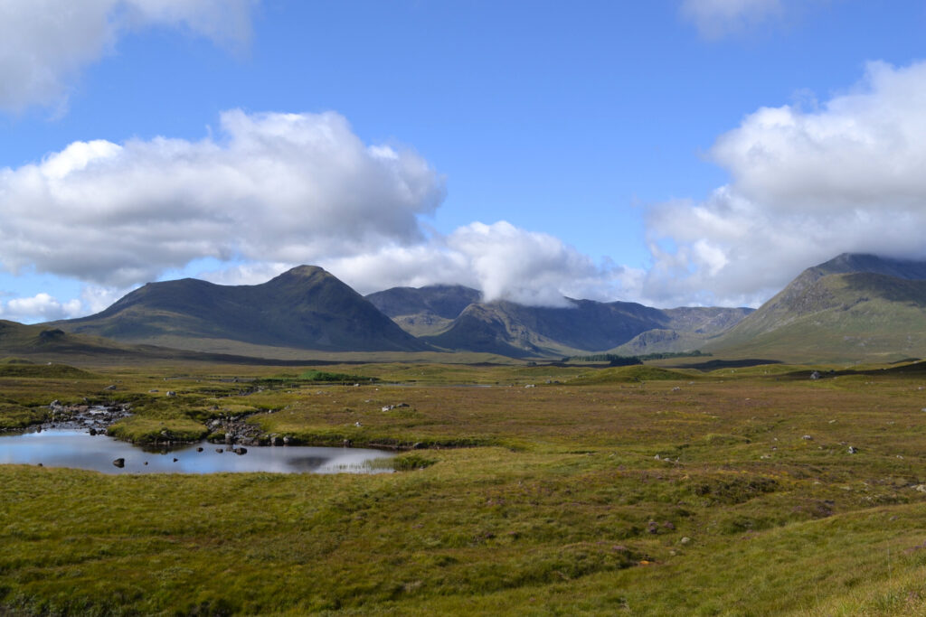
Header Image: Rannoch Moor is a vast area of peat bog at the juncture of Argyll, Lochaber, Atholl, Rannoch and Badenoch. While now considered one of Scotland’s great wildernesses, this landscape was once a busy hub of communication routes, and an important resource for the communities living around and on the moor who relied on this landscape now viewed as ’empty’ and ‘wild’ for grazing, hunting, farming and fuel (Image copyright: Edward Stewart)
