Sites to See on a Weekend on An t-Eilean Muileach (Mull) and Ì Chaluim Chille (Iona)

Off the west coast of Scotland lie An t-Eilean Muileach (the Isle of Mull) and Ì Chaluim Chille (the Isle of Iona). It’s thought that the islands have been occupied for at least 10,000 years and, if you know where to look, you can still find the remains of the past residents, from Mesolithic hunter-gatherers to early Viking settlers and beyond.
Muile (Mull) and Ì (Iona) are bursting with fantastic sites ready to be explored. Each island’s highlights listed below can be explored by foot or by car in a day, together making a handy weekend guide for archaeological exploration. Ready to unveil the hidden prehistoric and medieval past of Ì and the intriguing ancient monuments of Muile? Read on!
Moonlight, firelight and entry into the after world on Muile
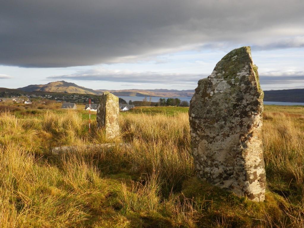
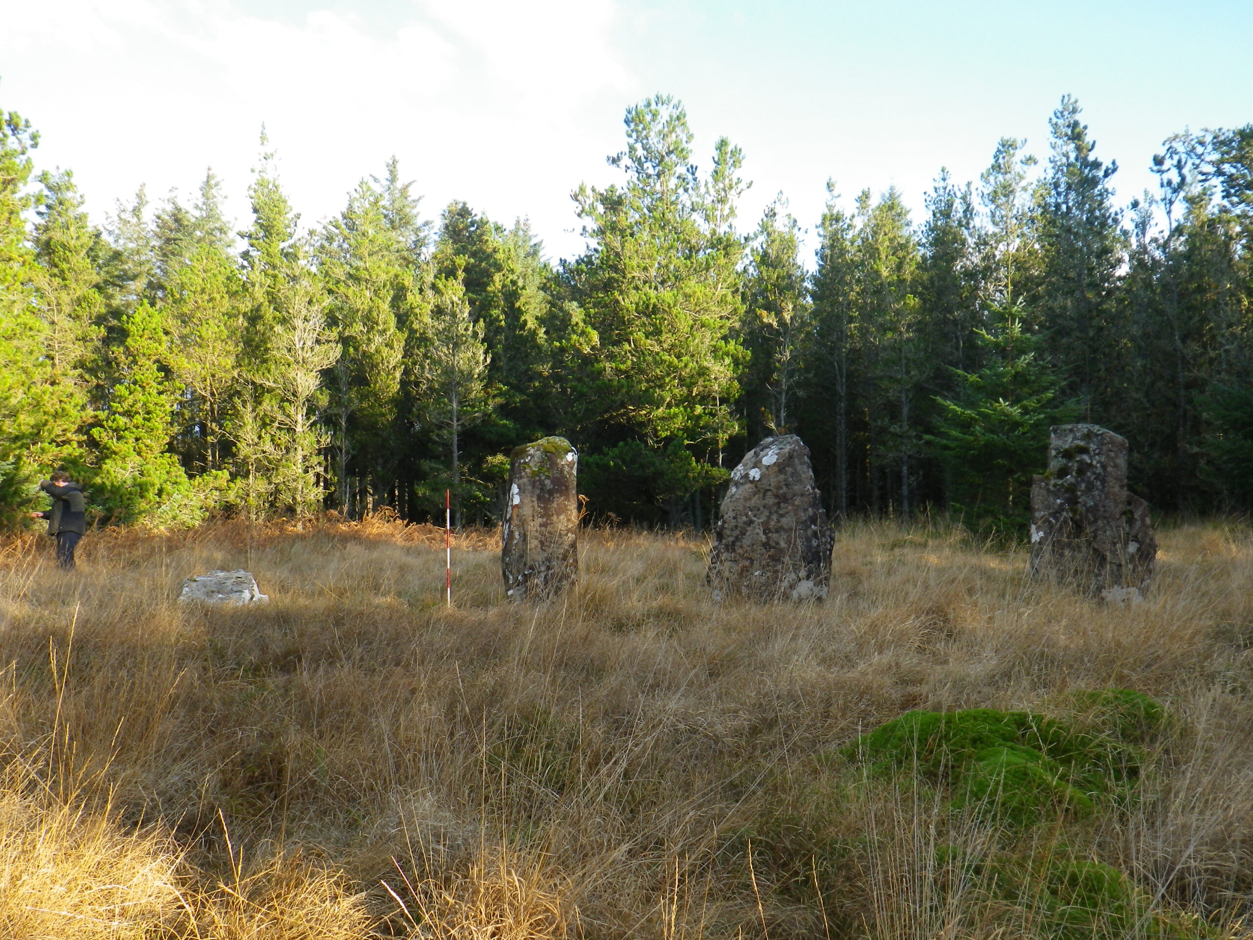
One of the most unique archaeological features of Muile is its abundance of short stone rows, a type of ancient monument made up of three to five standing stones arranged in a line.
The date and function of these mysterious monuments remains unclear, but archaeologists think that they were built around 3,000 years ago to follow the path of the moon throughout the year.
Baliscate short stone row, near Tobermory (© Argyll Archaeology)
Research has shown that the short stone rows in northern Muile are oriented so that the cycle of the moon could be tracked from them. The locations of the stone rows at Maol Mor, Cnoc Fada, Kilmore, Glengorm and Ach’nan Carragh were also chosen with the prominent peak of Ben More in such a position to be associated with the southernmost rising moon.
The moon being the most visible object in the sky was used to measure time using the number of days (roughly 28 days) between no moon and full moon. The lunar cycle is also closely associated with tides and fertility cycles.
The short stone row at Maol Mor, near Dervaig (© Argyll Archaeology)
Evidence from the three partially excavated sites of Ardnacross, Glengorm and Baliscate indicate that as well as tracking the moon, other rituals that took place within these monuments included the extensive use of fire as well as the burial of the dead. Quartz chippings and crystals found scattered across these sites suggest these rituals were accompanied by flickering and dancing fire and moon light which refracted and reflected off the quartz. It has been suggested that these monuments acted as ‘portals to the underworld’.
Interestingly, quartz has been associated with housing the spirits and a means of connection between this and the after-world since Neolithic times[1]. There are eight (possibly nine) stone rows all found in spectacular locations in the northern and eastern part of Muile, all of which can be readily visited.
Following in their Footsteps: Prehistoric and Medieval Ì
Ì is famous across the world for its iconic medieval monastery. Founded almost 1,500 years ago in 563 AD by Saint Columba, this early centre of Christianity grew into one of the most significant pilgrimage sites in Western Europe.
The current 13th-century abbey building, built on the site of Columba’s original church, is an impressive sight but as you leave the ferry and follow in the footsteps of the countless medieval pilgrims before you, be sure to stop and appreciate the wealth of hidden history on the way.
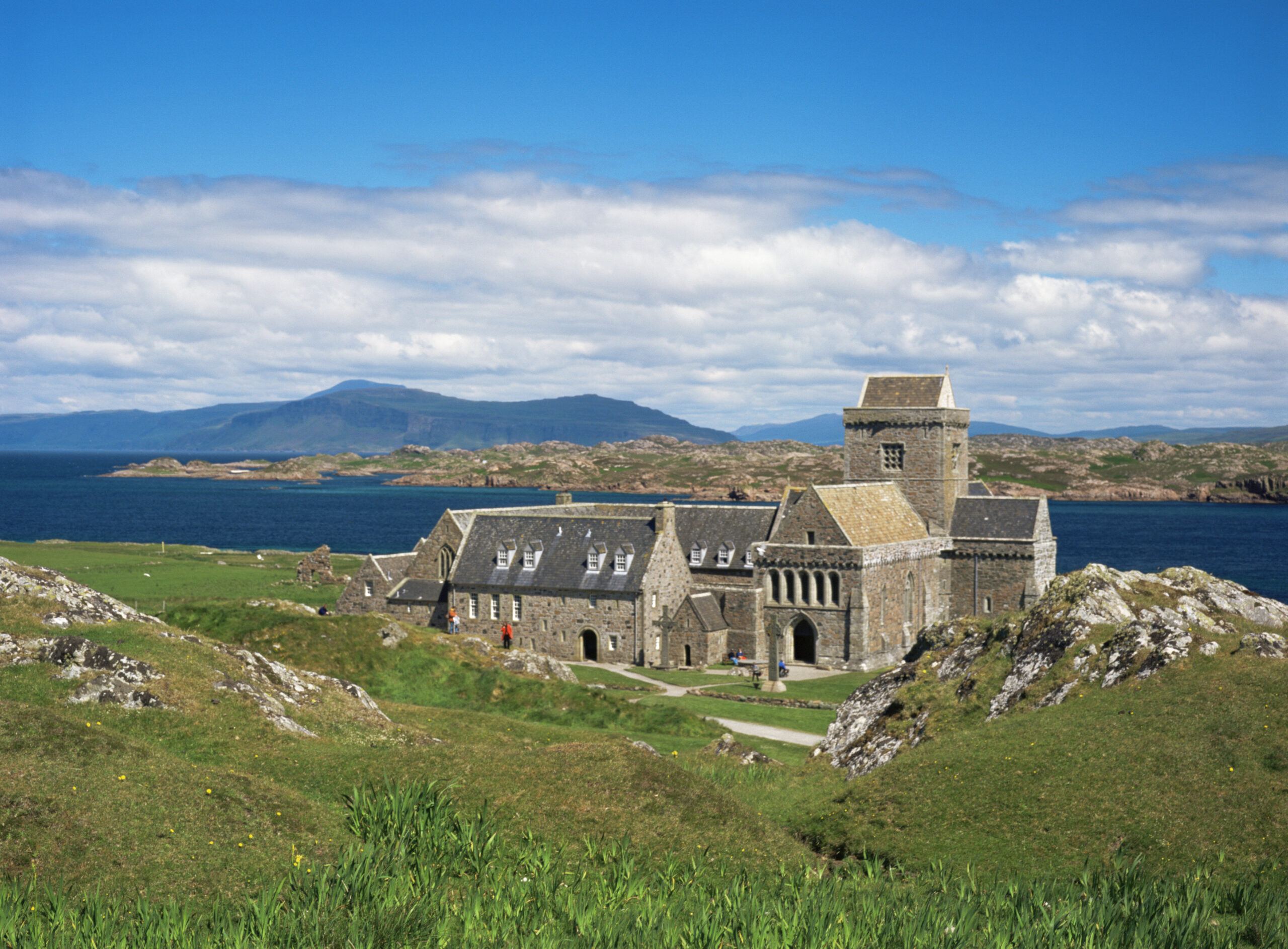
Iona Abbey, Isle of Iona (© VisitScotland / Paul Tomkins)
When travelling up the hill to reach the monastery, take a look back at the sea and imagine yourself standing on an ancient cliff against which the water lapped around 5,500 years ago. The high sea level was a consequence of the melting ice sheets at the end of the last Ice Age, which had gradually receded before Columba arrived on the island in the 6th century AD.
On the terrace above this shoreline (in the fields behind the craft shop and below the primary school) lies ancient soil buried beneath more recent midden deposits (a midden is a kind of rubbish heap). This soil was found to contain 8,000-year-old worked flint and stone tools discarded by hunter-gatherers who many years ago exploited the rich natural resources of Ì.
Other buried soils on the eastern side of Ì have shown evidence of human activity on the island from the early Bronze Age (around 3,500 years ago) right through to the late medieval period (16th century AD). In a garden opposite the craft shop, a late medieval buried midden may have originated from the Augustinian priory (known locally as the nunnery).
Analysis of the bones found in the midden revealed that the nuns who lived on Ì had a varied diet and one which was rich in cattle and fish. Interestingly, evidence from fish bone analysis indicates that the type of fish within the midden changed with time. The type of fish present in the lower portion of the midden would have been caught using a line, while some of the fish evident in the upper midden would only have been able to be caught using drift nets thus indicating the progression of fishing techniques on the island.

The early medieval ditch running under the primary school and village hall (© Argyll Archaeology)
When you pass the new village hall and the primary school, you’ll be walking along the length of a large ditch constructed sometime before the late 8th century AD. Now buried under the road, this ditch is probably from the time when pilgrimage to Ì became ‘fashionable’ and the monastery expanded to accommodate all its new visitors.
Intriguingly, a beautiful late medieval decorated stone cross-head was found discarded within the topsoil of the primary school (indicating that it was relatively recently cast away). We know that the cross-head would have been commissioned by a rich person in the 15th century as a way of patronage to the church, but who threw it away and why remains a mystery.
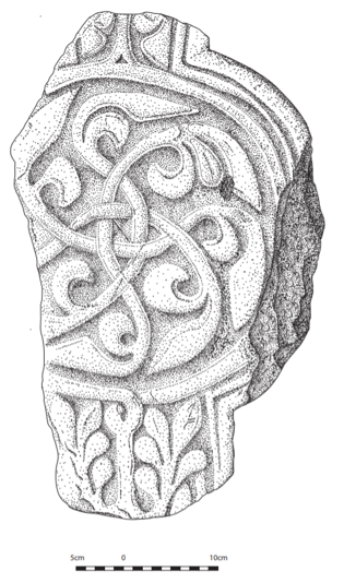
Late 15th-century chlorite (a type of rock) cross-head found at the primary school (© Argyll Archaeology)
Finally, when you’re nearing the abbey look out for McLean’s cross below the new housing estate at the Glebefield, which marks the junction of three medieval streets. Just beyond the cross was the site of an excavation which uncovered a series of middens and finds, including a beautiful Norse period copper alloy pin. Excavation within the garden ground of the nearby St Columba Hotel demonstrated that part of the early medieval vallum ditch enclosure complex of the monastery also runs through here. This indicates that this area, prior to the existence of the St Columba Hotel, would previously have been within the monastic complex.
Now that you’ve reached your destination, you can impress your fellow visitors with your knowledge of the islands hidden archaeological gems!
Learn more about the history of these islands and their major archaeological and historical sites in David Caldwell FSAScot’s book Mull and Iona, A Historical Guide (2018) and be sure to check out the Visit Mull & Iona website to plan your visit when it is safe to travel.
By Dr Clare Ellis BA, PhD, MCIFA, FSAScot, archaeologist and director of Argyll Archaeology.
[1] [Thompson, T F 2005 Clocha Geala/Clocha Uaisle: White Quartz in Irish Tradition. Béaloideas: Journal of the Folklore of Ireland Society 73. 111-33.]
(Header Image Credit: © VisitScotland / Paul Tomkins)
