Not Just Digging: What You Need to Know about Community Archaeology in Scotland (English)
WHAT IS COMMUNITY ARCHAEOLOGY?
Community archaeology is driven by communities who are led by their passion for the past and/or commitment to their ‘place’. These projects are often organised by local archaeology, history or heritage societies, sometimes as part of larger landscape-wide initiatives. They encourage participation and provide varied opportunities for people to get involved.
Many groups will choose to work with a team of professional archaeologists, perhaps a commercial unit or other professional organisation that specialises in community heritage. The archaeologists usually take overall responsibility for the excavations and the post-excavation reporting and analyses. They also provide tools/equipment and training for participants, and often deliver a wide range of other activities such as working with schools, delivering workshops, and coordinating a wider programme of engagement.
Participation in these projects is usually free since they are often funded by organisations that seek to strengthen communities, facilitate skills development and training, and promote engagement with heritage.
What Kind of Tasks Can I Do in Community Archaeology?
Excavation
Excavation involves digging specified areas of an archaeological site to find out more about its nature, form and date. Most digging takes place using a small trowel but heavier tools like mattocks (shaped like a pickaxe) are used to move more quickly through deep deposits that are unlikely to contain very sensitive material. You almost certainly won’t use a paintbrush!
If you’re worried about the physical demands of excavation, let the organisers know beforehand and they can usually find a day/task that will suit you.
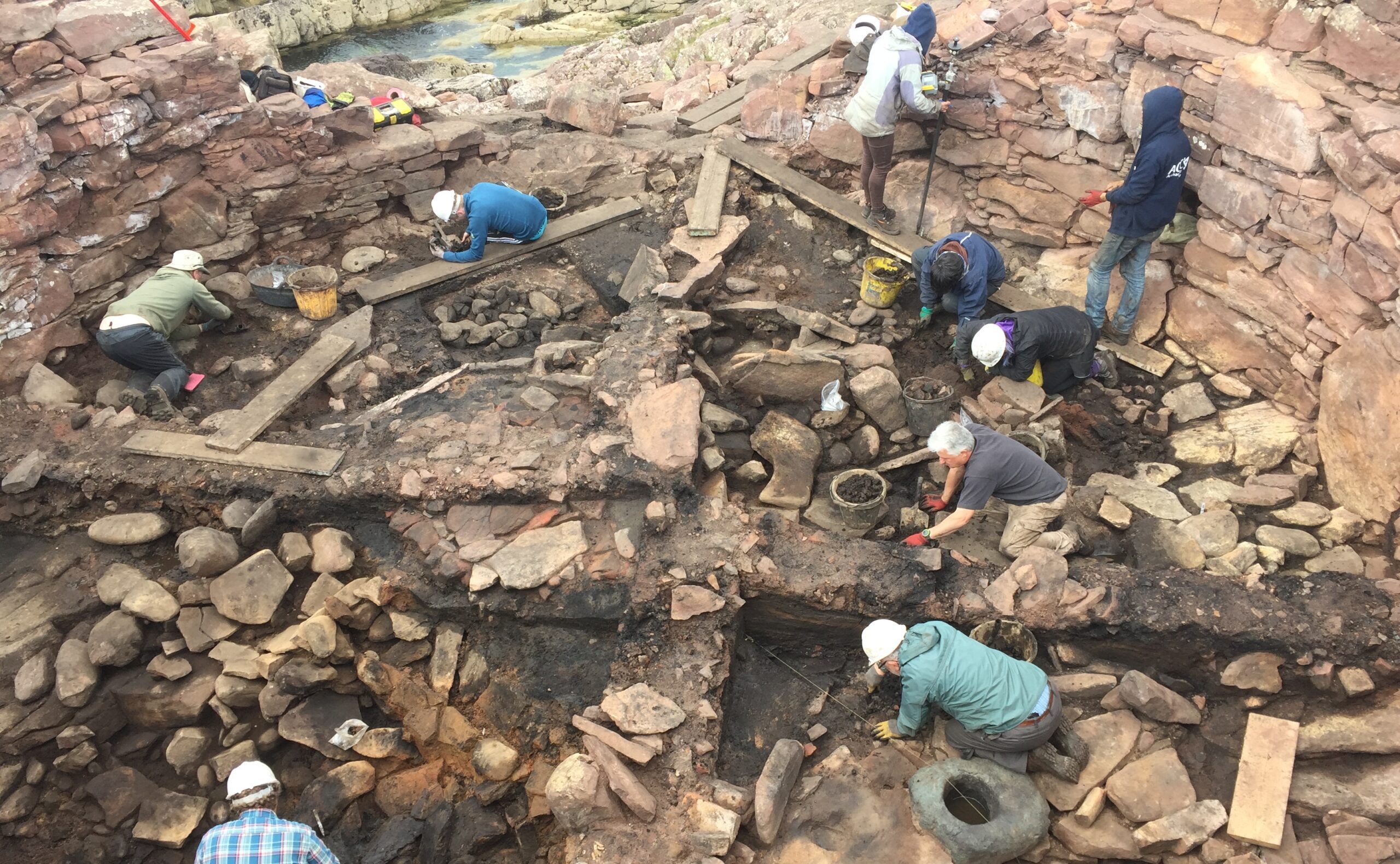
Digging a large, complex site like Clachtoll Broch is a team effort (© AOC )
Recording
Everything exposed during excavation is recorded carefully and accurately. Features are drawn to scale by hand, photographed, and even recorded in three dimensions using cutting-edge technology.
Doing the drawings is a bit of a Marmite task – some people love it, others hate it – but it is an essential part of the excavation process. Getting involved in the recording is a lower impact activity and is often preferred by those who are less able to do strenuous physical work.
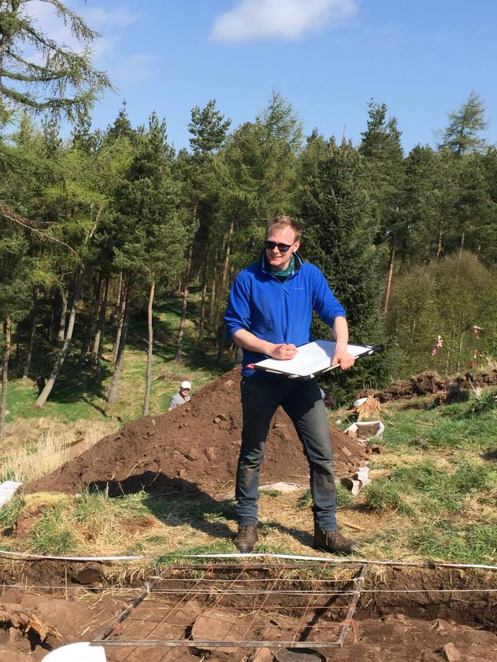
Making plans and section drawings during excavation on Moncreiffe Hill as part of the Tay Landscape Partnership (© AOC)
Measured Survey
Making accurate plans of known sites makes a huge contribution to the archaeological record. Mapping out the features that are visible on the ground allows for better interpretation, and can also be used to monitor impacts such as erosion.
Survey can be carried out manually, using a plane table and tape measures, or digitally using cutting edge equipment such as a total station or GPS.
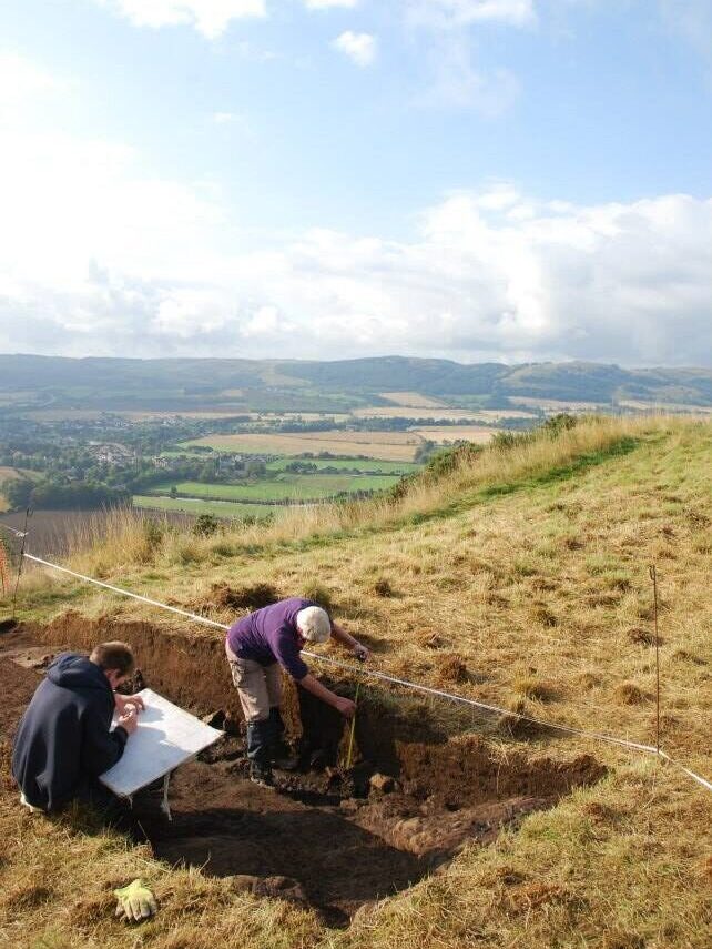
Making plans and section drawings during excavation on Moncreiffe Hill as part of the Tay Landscape Partnership (© AOC)
Walkover Survey and Ground-truthing
New archaeological sites are identified all the time. Walkover survey can involve looking for new sites in the landscape, checking features that have been flagged up as possible sites, and surveying known sites. Possible or confirmed sites may be photographed and sketched, described in a written record, and perhaps recorded digitally or in a measured drawing too.
Lots of new sites were identified in recent years through a community project led by Castletown Heritage Society in Caithness, for example.
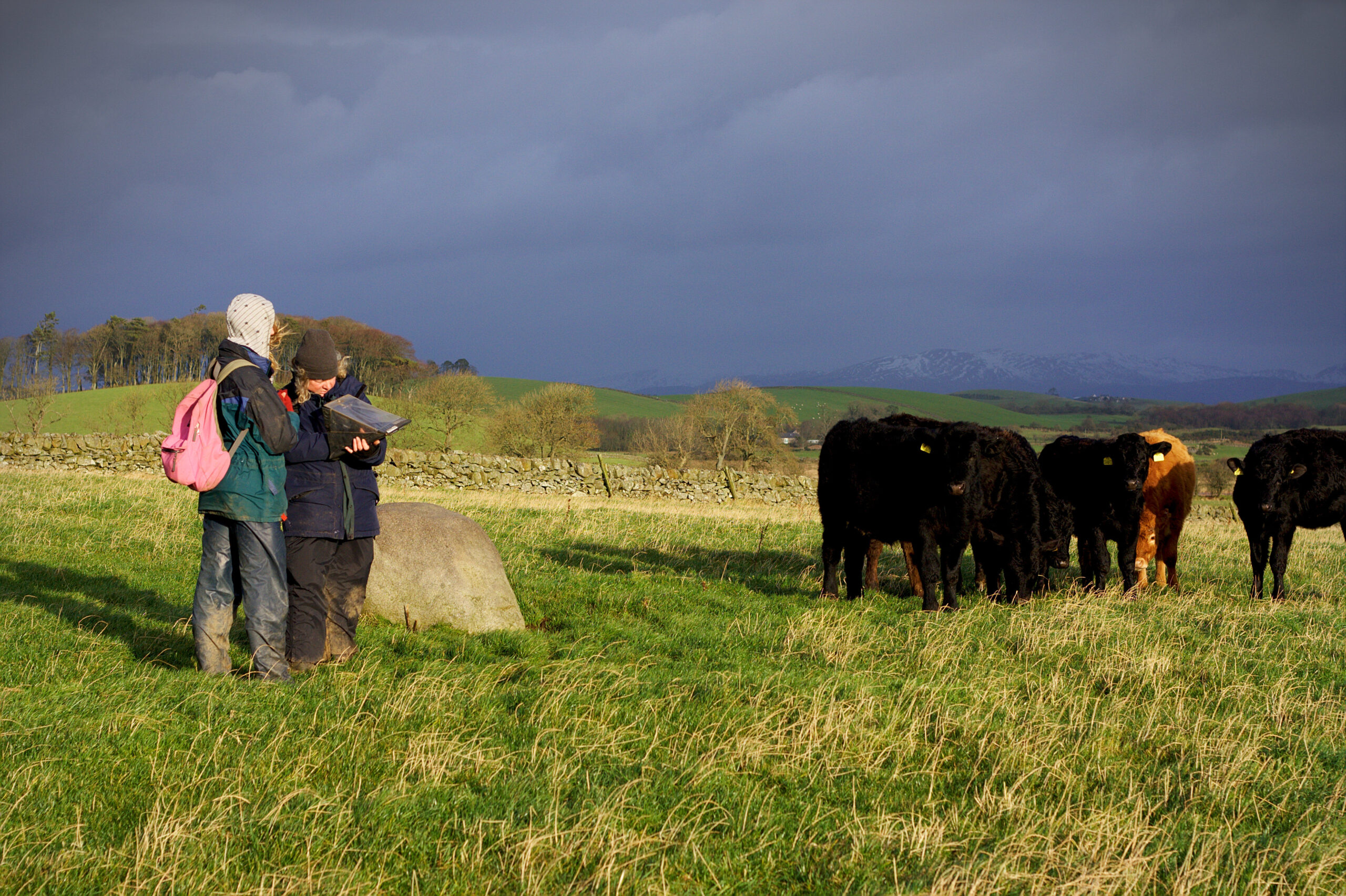
Walkover survey can involve trekking long distances to remote sites, but you get to make lots of new friends, hooved, horned or otherwise! (© AOC)
Finds Processing and Cataloguing
Finds often need to be washed, dried and sorted before they are analysed and written up. Sometimes this takes place onsite, but more often it is done indoors. The finds also need to be catalogued. Volunteers catalogued hundreds of finds from Clachtoll Broch in Caithness, for example, by creating written records for each artefact.
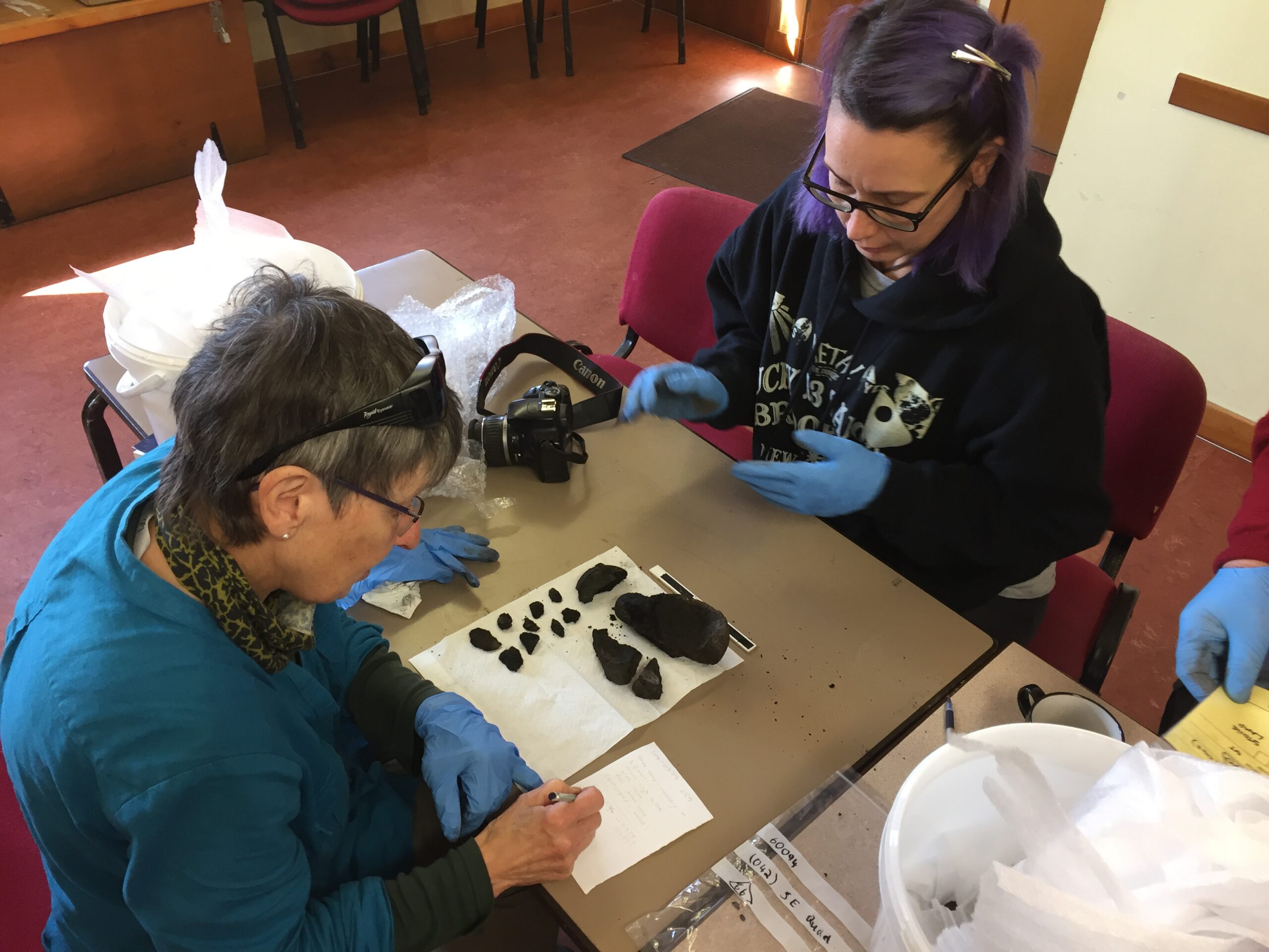
Volunteers cataloguing the finds from Clachtoll Broch (© AOC)
Field-walking
Field-walking is a technique for identifying evidence of past occupation by walking systematically across a ploughed field, scanning the ground by eyes and picking up artefacts that have been pulled to the surface by the plough.
Field-walking is an excellent way of pinpointing areas of past activity by identifying dense concentrations of finds, particularly lithics – stone tools – which provide important evidence for the people who lived in Scotland in earlier prehistory (roughly 14,000 to 2,000 years ago).
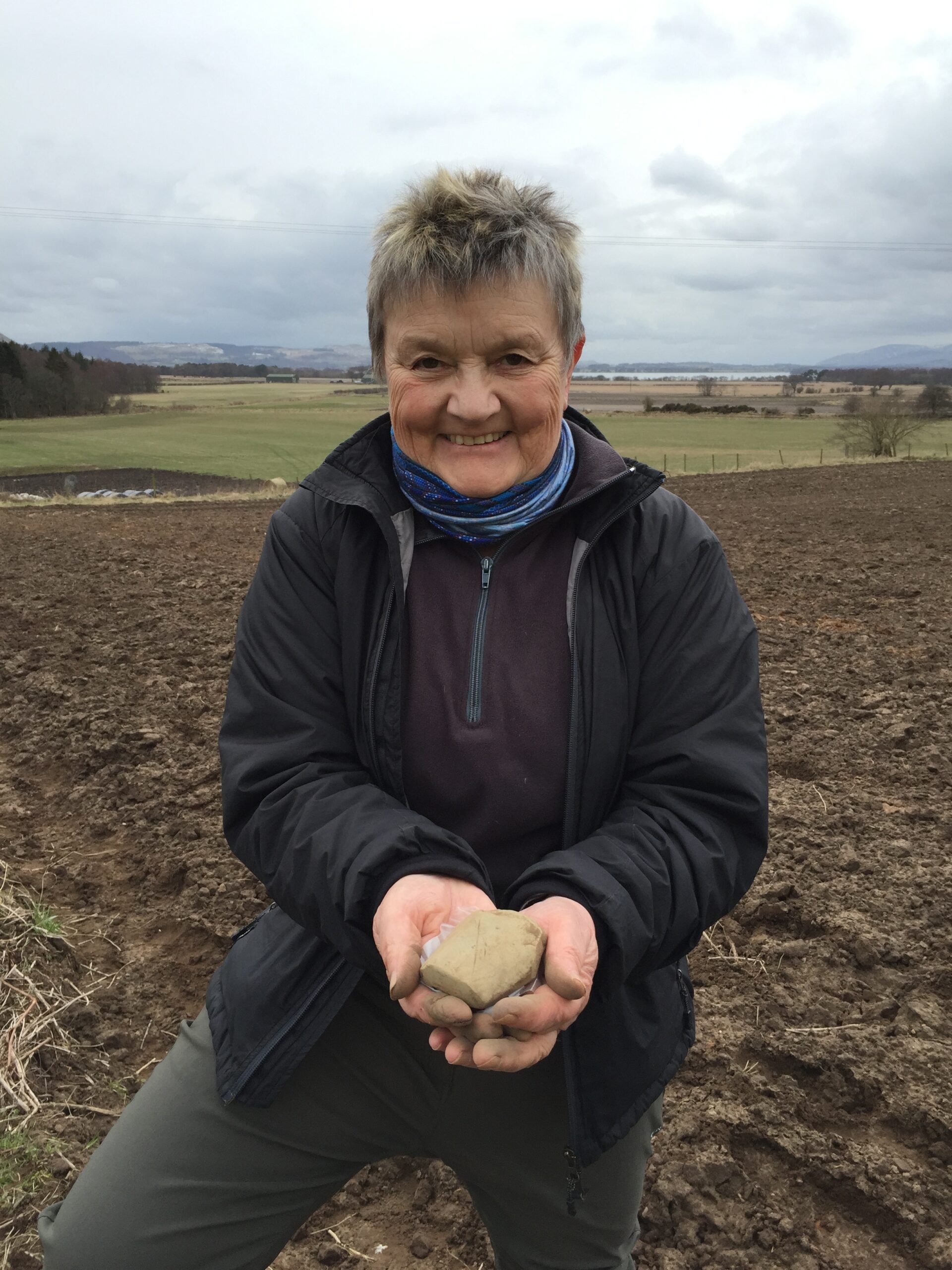
Have you got eagle-eyes for spotting worked stone among the mud? Fieldwalking at Kilmagadwood with Perth and Kinross Heritage Trust (© AOC)
LiDAR analysis
LiDAR (Light Detection and Ranging) uses airborne laser scanners to create 3D models of the landscape. This resulting data is used to visualise existing sites or identify new ones. The data can be manipulated to remove overlying vegetation such as trees, bracken or gorse. This allows for the identification of sites and features that were previously obscured.
Some community archaeology projects train participants to read the LiDAR data, and invite them to search through the data for a specific area, looking for new archaeological sites. This can be done from home using a standard computer or tablet. This stage is often followed up by walkover survey, to ground-truth possible sites.
Participants in the Whithorn Trust’s ‘Machars Waterborne’ project, for example, have identified hundreds of new possible sites this way.

The interactive web map created using LiDAR data – 3D models of the landscape created using aerial laser scan data – of the Machars (Whithorn Trust and AOC)
Which Archaeological Activity Should I Choose?
There are lots of ways to get involved in archaeology – you don’t have to dig! If you hear about an upcoming project that interests you, get in touch with the organisers and find out what’s on offer. You might just find your new passion.
If you can’t wait to get started, click here to dig into archaeology events.
By Charlotte Douglas, community archaeologist for AOC Archaeology Group. Charlotte has been involved in the design, development and delivery of public archaeology projects for local societies, community groups and landscape partnerships across Scotland.
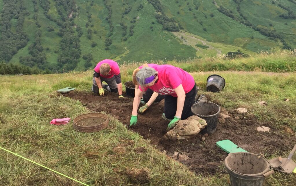
Header Image: Looking for adventure? Community archaeology might take you to unexpected places, like a hillfort amidst the dramatic scenery of Glen Nevis! Excavations at Dun Deardail (© AOC)
