What is Photogrammetry and What Has It Uncovered in Scotland?
Photogrammetry is a digital imaging method that’s increasingly used in cultural heritage and archaeology to create 3D records of artefacts, sites, or landscapes.
There are several types of photogrammetry, but the version most often used in these contexts is structure-from-motion (SfM) photogrammetry.
As the name implies, by taking many overlapping photographs from different positions around an object, the software identifies shared features in the areas where the photos overlap. Ideally, you want flat lighting in your photographs to minimise shadows, as the software won’t be able to ‘see’ details in strong shadow; Scotland’s often-overcast sky is great for outdoor photogrammetry.
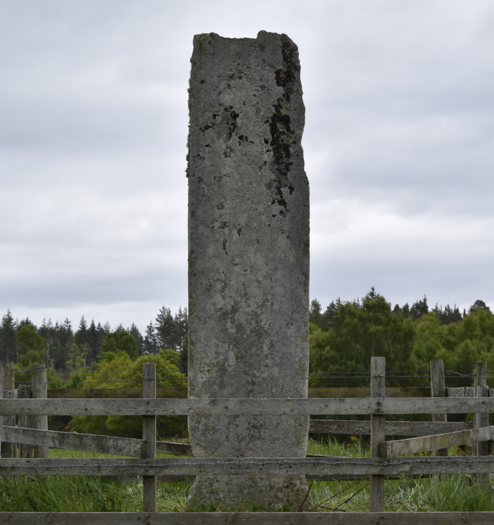
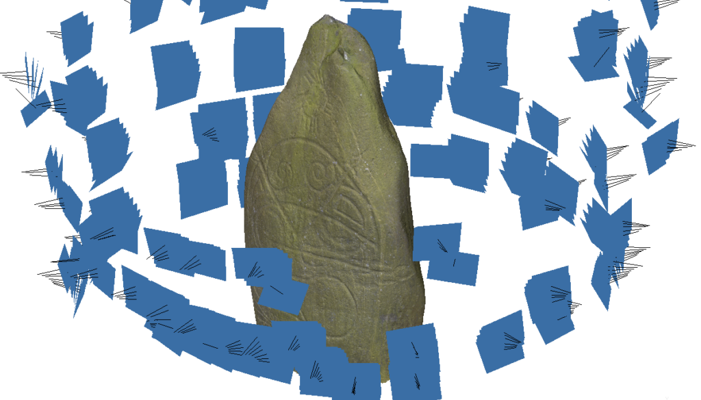
The Altyre Stone in Moray (S-MOR-002) on an overcast day, perfect for photogrammetry! (Image credit: Dr Megan Kasten FSAScot)
Based on the shared points the software identifies, it then calculates where the camera was in relation to the object when each photo was taken and uses these measurements to create a point cloud of the shared points identified on the object’s surface.
The software uses this camera alignment, point cloud, and various camera metadata to calculate a dense point cloud or depth maps; these can then be used to create a 3D mesh, or a digital representation of the physical surface.
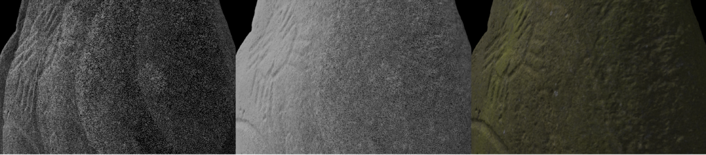
A composite image of the point cloud, the connections the software created between the points, and the photorealistic mesh of Logie Elphinstone in Aberdeenshire S-ABD-002 (Image credit: Dr Megan Kasten FSAScot)
What are common misconceptions about photogrammetry?
There are several different methods available to create 3D models, many of which are colloquially referred to as ‘laser scanning’. However, these technologies all use different ways of capturing 3D measurement data.
Laser scanners use actual lasers to take measurements from the surface of an object, and often operate under either a time-of-flight or triangulation principle.
In contrast, structured light scanners have at least two cameras built into a unit that measure distortions in a known pattern of light while it’s projected across the object.
Finally, photogrammetry takes measurements from overlapping photos as described above to create a 3D record.
Other, newer image-based methods like Gaussian splats and NeRFs are also gaining interest amongst archaeologists and historians, though these tend to focus on creating photorealistic outputs, rather than creating a 3D model with accurate mesh geometry.
Though photogrammetry is sometimes considered to be less accurate than other 3D recording methods, it’s capable of producing sub-millimetre accuracy with careful data capture. Earlier forms of SfM photogrammetry required more user intervention to identify points, but modern photogrammetry software packages have become significantly more accurate in feature identification. As photographs don’t contain scale information implicitly, scale bars do need to be included in the scene for scale to be defined in the photogrammetry software.
Another misconception is that photogrammetry is a fast process. While the data capture can be done quickly in ideal conditions, the data processing tends to be less so!
What has photogrammetry uncovered in Scotland?
Often when recording an object or monument with photogrammetry, something new is discovered.
This is partly because of what the recording process of photogrammetry requires. To get a complete 3D model, you need to take clear photographs of the entire surface of the object, including the ‘uninteresting’ parts where there’s no obvious carving, or the back/bottom surface of an object that may have been inaccessible while the object was on display.
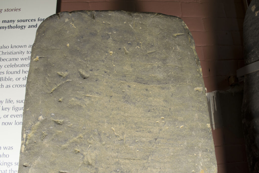
The very eroded surface of Govan 31 which still retains areas of 10th-11th-century carving (Image credit: Dr Megan Kasten FSAScot)
This is what happened during the condition assessment and 3D recording of the Stone of Destiny, an ancient symbol of Scottish monarchy and kingdom which is still used to crown kings and queens of the United Kingdom today.
Historic Environment Scotland’s Applied Conservation, Heritage Science, and Digital Documentation teams discovered a previously undocumented incised inscription of what appear to be several Roman numerals. The team believes these may have been added during the stone’s more recent history, in the 20th century.
Recording heritage in 3D is particularly useful for weathered stones. The colour of a stone surface can be visually distracting, so removing this colour and digitally enhancing the surface of the 3D record based on its geometry reveals worn carved details.
An example of this is the heavily eroded ogham-inscribed stone from Pool in Orkney. Ogham is a script that was likely invented in Ireland in the 4th century AD and continued to be used throughout the medieval and modern periods. Its structure is based on the Latin alphabet and the sounds of the Irish language from the time of its invention.
Usage of the script spread across the British Isles and seems to have been used in Gaelic Scotland and Pictland from the 5th-11th centuries AD (spanning both the ‘classical’ and ‘reformed’ ogham periods, which you can read more about here).
While I was moving the lights to create flat lighting, I noticed what appeared to be a boot-shape in the lower left part of the stone. Once I’d processed the data and applied different angles of raking digital light, a previously unrecorded and very weathered hooded human figure became visible.
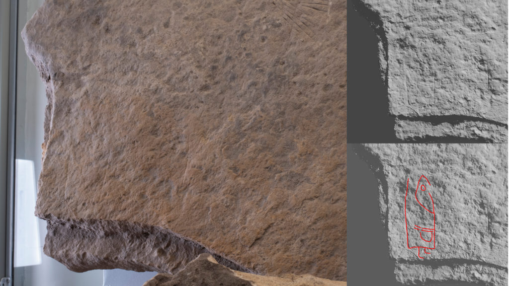
The bottom left corner of Pool (S-ORK-008) when photographed (left), processed into 3D (top right), and with the newly identified carving outlined in red (bottom right) (Image credit: Dr Megan Kasten FSAScot)
There are also other ways to visually enhance carved surfaces in 3D models. In the case of a 16th-century inscription at Kirkmichael church on Black Isle, Andy Hickie of Avoch Community Group applied ‘Red Relief Imaging’ (a tool originally designed to visualise landscape features intuitively) to a photogrammetric model to make the eroded inscription legible again. Their analysis revealed that the stone reads:
‘HIS VMQ FATHER RONALD VRQ/IN FERRITON Q ***TIT YIS LYF YE 28 OF SEPTEBER/1575 AND OF HIS VMQ MOTHER ELIZABET HALIBVR-/TON Q DEPTED YIS LYF THE 13 OF FABRVAR 1583’
The panel was erected in 1584 by someone named John (IHONE) Urquhart to commemorate his parents and whilst John Urquhart of Ferryton crops up in a few documents of the period, his parents are never mentioned, which means that this is new information.
In other cases, like the graffiti from Kilchattan Old Parish Church in Argyll recorded by AOC Archaeology, a local relief model (an algorithm designed to highlight shallow features) can be applied to the photogrammetric models to highlight carvings. Similar, though less refined, results can be achieved using free software, like Meshlab, where users can apply a range of ‘shaders’ to emphasise carved areas.
Beyond visualisation, photogrammetry data can be utilised as a research tool. Digital data can be copied and hypotheses can be tested on those datasets.
I’ve ‘digitally worn down’ examples of known interlace patterns from the 3D models of sculpture at Govan Old Parish Church in Glasgow, home to an internationally significant collection of Viking-age monuments, to compare them to unknown, naturally weathered patterns from the collection.
When a medieval gravestone from Inchinnan in Renfrewshire was discovered to have originally been an early medieval carved stone belonging to the 10th-11th-century Govan School, I also used these to reconstruct the decoration of Inchinnan 5.
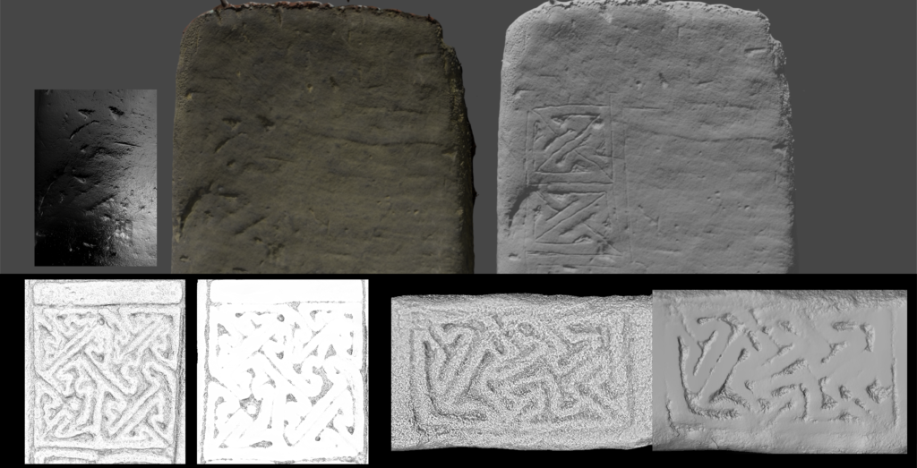
Reconstruction of the worn patterns on Govan 31 by comparing to digitally worn patterns from the 3D models of Govan 7 and Govan 10 (Image credit: Dr Megan Kasten FSAScot)
“Where can I see photogrammetry models?”
At the moment, Historic Environment Scotland, universities, museums and archaeology companies make their 3D models available on websites like Sketchfab.
However, some projects have their own websites where they host their photogrammetry data, like we have for the OG(H)AM project on the ‘Ogham in 3D, v.2.0’ database.
“Can I get involved in photogrammetry? If so, how?”
The best way to start is to try it out for yourself!
There are a number of photogrammetry phone apps that include cloud processing of the photographs, which means you don’t have to have an impressive computer to process your data into a 3D model – though be aware that many start ‘free’ and require you to pay a subscription fee after.
An exception to this is KiriEngine, which currently offers all of the functionality you need to start creating and working with 3D models for free.
There are occasional training opportunities through the Engine Shed in Stirling, but readers should also keep an eye out on the Dig It! website, as community excavations or other community-focused heritage projects (like the excellent, but now completed, Scotland’s Rock Art Project) may offer photogrammetry training opportunities.
By Dr Megan Kasten FSAScot, Research Affiliate with Archaeology and Celtic and Gaelic at the University of Glasgow, and Visiting Lecturer at Glasgow School of Art: School of Innovation and Technology.
Header Image Credit: Dr Megan Kasten FSAScot
