Rediscovering a Lost Highland Community
In 1820, 5,000 years of occupation of a Highland settlement site – dating back to the late Neolithic era – came to an end with the Clearances by the MacKenzies of Coul.
Over two years, the long-held tenancies of 77 families were terminated, making Inverlael one of the larger evictions at that time, with as many as 500 people removed from the settlement. This event devastated what had been the main settlement in the Lochbroom area, on the west coast of Scotland, since the 13th century.
Unlike many other Clearance sites, there were no newspaper articles about this event, no recorded resistance from the tenants, no national outrage and no local memory of this eviction, which had removed all traces of “the biggest [early modern] settlement north of Dingwall”.
Instead, Inverlael seems to have quietly dissolved into the landscape with little fuss or notice and its people were absorbed for the most part into Ullapool and surrounding areas, with a few emigrating abroad.
The uncomfortable fact is that it probably came as no surprise to the tenants, who more than likely saw very little point in fighting the evictions, and instead silently resigned themselves to leaving the land they had lived and worked on for generations. The lack of a violent struggle, however, does not take away from – and in our opinion adds to – the wretchedness of the tenant’s situation.

Wester Ross, Pont 4, Timothy Pont (© National Library of Scotland)
In 2020, the Lost Inverlael project was founded on the memory of the Highland Clearances and aimed to give some measure of justice to the lost community by telling their story 200 years later. But in the end, we found that the best way to commemorate the community’s untimely end was to explore how the site’s residents lived for thousands of years before the Clearances.
What’s the Lost Inverlael Project: A Lorg Baile Bhlàir?
Lost Inverlael: A’ Lorg Baile Bhlàir, was a three-year archaeological, research and community engagement project ran by Ullapool Museum Trust and funded by Historic Environment Scotland, Forestry and Land Scotland and Bord nà Gàidhlig.
Local amateur historian and Inverlael descendant, Duncan ‘Bain’ MacKenzie, had been personally researching Inverlael’s history for several years through stories that had been passed down by his grandfather. Impassioned by the lack of any research or local knowledge on the stories of Inverlael, he brought the idea to Ullapool Museum in the summer of 2019.
From there, Ullapool Museum created a community project that saw the first archaeological surveys conducted on the area by students from Ullapool High School and local volunteers, three archaeological excavations, and research trips to archives in Edinburgh. Other projects included a radio drama series, Minecraft games, a portrait exhibition, a community ceilidh with specialist music commissioned for the project, as well as finds workshops, children’s activity packs and several talks.
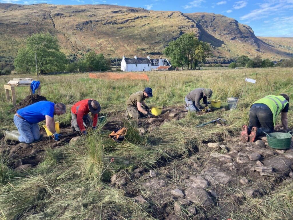
First excavation, Residential Building, Oct 2021 (Credit: Ullapool Museum Trust)
What Was Uncovered at Inverlael?
It became clear very early in the project that we needed to shift focus from ‘The Clearance’ story to one that was much more inclusive of earlier periods in Inverlael’s history. We knew that there would be no burnt houses to observe at Inverlael; this was not a frantic evacuation where people only took the essentials and left everything else.
We have every reason to believe that the tenants knew what was coming and packed everything up with plenty of time and left without fuss, which leaves almost no material evidence for us to find 200 years later.
The majority of the finds during the excavations were relatively modern ceramics and discarded glass, which gave us little information on the evictions themselves, so we decided to focus our investigation on the earlier phases of occupation at Inverlael. No real archaeological surveys or excavations had ever been carried out on the settlement, nor had there been any historical research that focused solely on Inverlael. Essentially the history of this settlement was a blank slate, and our aim became to fill as much of it as we could to honor the past residents.
We began devouring any historical record we could find, no matter the period, which also opened up our perspective on archaeological finds. Any information we could absorb into the project the better it would be for the historical record and future research.
Neolithic Thumb Scraper
This thumbnail scraper was found in Trench 7, which was placed over a small cell-like structure which we thought could have been a toll booth for Inverlael’s old bridge. It would’ve been used for woodworking, to soften or clean meat from hides around 5,000 years ago (c.3000 BCE). This was the only find to come out of this trench and the piece of flint was not in situ (in its original position) and had been caught up in the tumble of one of the walls.
While it didn’t give us much in the way of information about the site, it helps to prove the length of occupation in the area.
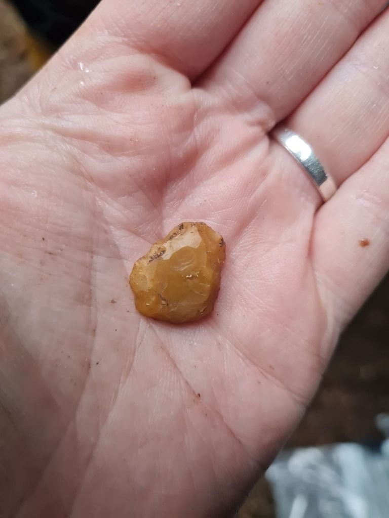
Neolithic thumbnail scraper, found in an unidentified building (Credit: Ullapool Museum Trust)
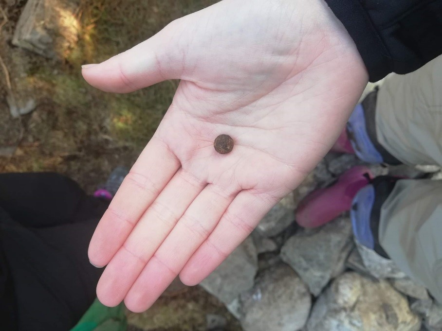
William and Mary Irish Half Penny
This coin from 1693 was found in the lade (channel) of what we think was an old mill building. We were originally able to identify it as either Queen Mary II or Queen Anne initially with the word “Regina” being visible. Later analysis showed an Irish harp and crown, which led to us being able to identify it as an Irish half penny from the reign of William III and Mary II.
This has helped us establish the use of coinage in the area and possibly suggests that the community had a trade link with Ireland in the 17th century.

1692 William and Mary Irish Half Penny, found in the trench that cut through the mill and lade (Credit: Ullapool Museum Trust)
Musket Balls and Musket Buckshot
Several musket balls and buckshot from around 1600 to 1650 were also found inside the proposed mill building around the hearth in Trench 1. The buckshot pellets would have been used specifically for warfare and not hunting.
We know that skirmishes were taking place here in the 16th and 17th centuries, but it’s good to see proof of that in the finds.
Buckshot ball, found inside the proposed Mill Building in Trench 1 (Credit: Ullapool Museum Trust)
As all of our digs were free to the public, with no experience necessary to take part, we were able to attract a large selection of volunteers from our local community, including ones who were drawn to the project because of family ties. Several who excavated the mill were descendants of the miller who had lived and worked in the very building they were excavating.
Some were just keen to get together and socialise, as outdoor activities were promoted and made more popular during the COVID-19 pandemic. We also had several undergraduate archaeology students who attended our excavations as the first fieldwork they had ever participated in.
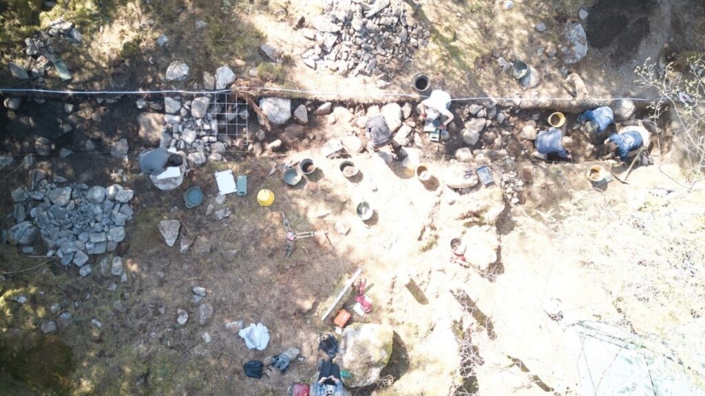
Second excavation, Mill Site, April 2022 (Credit: Ullapool Museum Trust)
How Can Archives Help Archaeology?
We found that the combination of archaeological investigation and archival evidence created a deeper and more meaningful interpretation of the area’s history. One of the main archival sources that was used during the project was the Calander of Writs of the Munros of Foulis (See SHG3048 – ‘Calendar of writs of Munro of Foulis 1299-1823’, Scot Rec Soc Vol. 72). As owners of the land at Inverlael until the mid-17th century, this family kept records depicting the type of land in the area, as well as key community facilities.
During the walkover surveys, the volunteers mapped the sheilings (summer grazing areas for cattle) and the types of buildings found in these complexes. Large domestic or residential buildings were identified along with multiple dairy safes and storage facilities, including some underground structures. The Calendar of Writs details the names of sheilings that are associated with the Inverlael settlement, such as “Dacharrie, Ferchesthie and Glendueldie” in 1590 and “Duthorie, Feachois, and Glendowaldie” in 1608 (although the spelling differs across the two entries, both accounts describe the same three sheilings).
Timothy Pont’s map of Wester Ross also details the locations, as well as the names, of various settlements along Gleann Na Sguiab, of which Inverlael sits at the mouth of, including the location of the ‘Glendowaldy’ shieling, which happens to correspond with the approximate location of the sheiling that the Lost Inverlael surveys identified. While archaeology has been able to identify the buildings and purpose of the area, archival evidence has been able to add names to them, as well as give some dating evidence.
Remembering the Clearances
Any discussion surrounding the Highland Clearances is wrapped in emotion and is deeply personal to those it has impacted. The generational trauma has passed down to descendants, and political and national implications ripple out from its core, which can make a community project on the topic quite challenging.
During this project we have been told many times: “why bother to excavate Clearance sites?”; “you already know what you are going to find”; “it’s not that long ago”; “what will it tell you that you didn’t already know?”.
Yet we have learned so much more about our local history, culture and heritage by daring to excavate a Clearance site. Inverlael has produced finds from the Neolithic, the Bronze, Middle and Modern Ages, and with time we believe will produce much more, helping us to tell a fuller story of this community.
To find out more about the Lost Inverlael project and other activities at Ullapool Museum, visit their website and YouTube channel.
By Siobhán Beatson, Manager/Curator of Ullapool Museum. Originally from Ayrshire, she moved up to Ullapool with her family in 2018. Siobhán graduated with an MLitt in the History of the Highlands and Islands in 2023 and is currently conducting PhD Research into the economies and land use of the sea loch communities of Wester Ross in the sixteenth and seventeenth centuries.
Want to keep reading? Explore more Highlands history through archaeological investigation in Eddie Stewart FSAScot’s Discover article.
Tweet
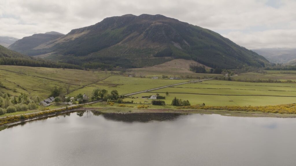
Header Image: Inverlael Landscape (Credit: Steven Gourlay Photography)
